
Disclaimer:
While I work full-time in the UK geospatial industry, have a professional background in addressing and location within GB and have a professional background in outdoor pursuits and navigation training, the views expressed here are purely my own personal ones. While they are informed by my professional background I cannot and will not speak on behalf of my employer on any forum other than their official channels.
TL;DR;
What 3 Words has pros and cons. While their solution is largely irrelevant in the UK due to a robust addressing framework and National Grid framework, they provide an alternative to an increasingly "grid reference fatigued" public. As such they have to be regarded as a disruptor to an establishment and the mere nature of discussions around them shows they have succeeded in exactly that. If W3Ws marketing department and material stuck more closely to facts and started marketing as an alternative method rather than a solution to a non-existent problem and the solution was open sourced or at least the source made accessible, then backing from the geospatial industry and professionals like me would be greater. All in all W3W is an alternative to existing systems in GB but doesn't provide any major advantages over existing ones if these are used correctly and for their intended purpose. Outside of GB W3W has the potential to transform thinking and solve actually existing problems in a novel way where previous systems have failed to gain traction.
Saddle up - this is a long(er) one...
If you're remotely interested in navigation, watch the news or generally haven't been living under a rock you will have likely come across What 3 Words (W3W). Let me be clear from the outset - if you are expecting a black and white opinion on their idea from this post then you will be disappointed. Equally if you are after a glowing review or scathing put-down, look elsewhere - I'm trying my upmost to be factual with this one.
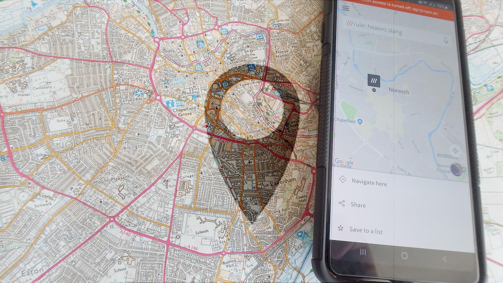
For those who don't know W3W have taken a Mercator projection (earth's globe in a flat plane) and draped a 3x3m grid over the top of it. Given W3W uses Google's mapping underneath it it is safe to assume their system relies on EPSG:3857 - also known as Web Mercator.
W3W have then, through a seemingly very clever, algorithm assigned unique 3 word references to each of these squares. References are not hierarchical and do not relate to each other in any way whatsoever. In order to obtain a reference or use one that is provided users must either use the W3W app or an enabled app (either implementing the W3W code providing the algorithm or making a call to the W3W systems).
What's the problem
In the UK (strictly speaking within GB) we are extremely fortunate to have a well developed, designed and working addressing system, a national geospatial infrastructure with a well designed national grid framework as well as the integration of our grid into the European Terrestrial Reference Framework. For those readers who don't like to hear that last fact - sorry, we are attached to the European mainland by virtue of geology and wherever it goes, we go. So we might as well ensure we take into account the tectonic movements in relation to this. I digress -
W3W identified a problem concerning large areas of the world - lack of adequate addressing infrastructure or nationally adjusted grid systems. Parts of rural Africa to this day describe locations by reference. Imagine needing a doctor to visit your sick relative and the "address" is something like "past the water hole, left at the old tree, right before the broken bus, straight until you pass the 4th bush, along the next stream by the large tree turn left and beep your horn so I can come find you". This was a real example provided by an international NGO as recently as the Ebola crisis in Sierra Leone.
Similarly there are cultures in this world where locations are described, not named. Especially in nomadic cultures such as Mongolia and to some extent the Aborigines in Australia, the notion of a definitive location name is largely alien. While descriptive locations are perfectly adequate for a society used to them and one that is largely vocal communication based, they are largely useless for systematic applications such as postal delivery or (modern day) navigation. Similarly I personally get fed up with hand writing relatively short addresses on letters, imagine a long description of a location.
The other areas where lack of addressing has become ever more problematic in recent decades are the slums and favellas around the world. Often developed outside of legal and social regulations, these sprawling and chaotic collections of dwellings are not only difficult but often utterly impossible to address in the traditional way. Nevertheless favellas often have their own infrastructure, their own places of interest to those living in it and often still receive certain public services.
Away from addressing the lack of a national grid reference framework can make definitions of locations cumbersome. While most people have heard of "GPS coordinates" or "lat/lon", hardly anybody outside of the geospatial industry realises that depending on which model of the earth we use to obtain and display the coordinates used, we can end up with the same lat/lon coordinates pointing to places hundreds of meters apart in real life. Importantly - none of the locations are wrong and indeed none are right either, as all are an arbitrary representation of a location on earth's surface.
Some countries such as the UK have developed a grid system specifically for them. The British National Grid takes into account distortions in representation of the earth's curvature in other common grid systems while also dealing with the fact that our island lies both east and west of the prime meridian. While the British National Grid is a fairly radical solution in geospatial terms, other countries have merely adapted existing closest fit reference systems to fit their specific purpose. In the United States most states have their own grid system, indeed some counties have their own, though regional and national systems also exist to allow interoperability. The more grid systems there are and the more complicated or arbitrary they seem, the less likely they are to be used by the public. Let's face it, how many of us could accurately (to the degree) give our lat/lon location without looking it up? That's the equivalent to a rough 111x111km square. It's N50, W1 for me by the way or 50, -1.
However, recent, and increasingly aggressive, marketing by W3W suggests that these problems surrounding lack of adequate addressing and location references also exist in GB. That's the same GB that has had a National Grid system available in its current form for over 50 years and has had Royal Mail deliver mail (and councils charge council tax for addresses) long before that. While no addressing system is perfect (just ask the Office for National Statistics around census time), ours is pretty solid in principle. Equally our National Grid may be a tad overwhelming at first, but fundamentally it boils down to 11 numbers describing every single square meter in GB.
So why apparently are people pining for a new system? To be honest - I don't think anybody was until they were told they were. I know that many people are unhappy with satnavs and postcodes, but that's down to satnav companies cutting corners and not buying accurate address data that provides a location for each address. Though arguably it's also us as consumers cutting corners and not buying systems that buy this data, but instead wanting everything for free. Newsflash - address data is commercial data and you're not going to get it for free. So we make do and use "the next best thing". If your delivery driver uses Google Maps to navigate to your address the problem is not with your address. In the same way, if your car doesn't float it is not generally a problem with your car.
But what actually is an address?
There are a number of definitions of what makes an address. To some it is merely a location, to others it is a history and a definition of a place, to others it is a code allowing efficient sorting of mail and to others it is a unique identifier of a taxable property - to name just a few.
Most of us in GB and indeed many western nations refer to locations by their address or an address like structure daily. As an example, "The Tesco by the stadium" is a perfectly viable address for anybody in the same city as me. Similarly "the big Tesco off the island" or "the big Tesco in town" should give enough information for somebody around here to know where to go. This method of addressing works because of context. The context for the information is that I am referring to the city I am in at the moment. In a similar vain if I tell someone I'm heading to London for the day I likely don't mean London in the US. I may do - but then I would also likely give more context, such as "I'm heading to London in the states for the day".
100 Victoria Embankment
LONDON
EC4Y 0HQ
Taking a look at this address, we see that to define the "where" of the "what" we only need two lines. The post town "London" and the street address "100 Victoria Embankment". In other words as long as I get to London and hop in a black cab I will get to the address. Not only that, both "London" and "Victoria Embankment" will give those in the know an idea of the size and status of what I might find here. All from an address. And before you go off searching - it's the HQ of Royal Mail Group.
It is this context that makes addresses more than just a location or a place to deliver stuff to. Social scientists and researchers can tell you a fair bit about your likely upbringing by you giving an address. Starting with the country, up to county level (though arguably this is not an official part of a UK address these days), to the post town, to the street and finally the house number or name. Addresses allow us to build a picture of the surrounding area. They nest, they are hierarchical and they are fundamentally engrained in our understanding of spaces and places.
"Where are you from" is a fairly basic question in our society and the answers are often selected for effect while staying remotely close to the truth. Someone from Chelsea is likely to say "Chelsea" rather than London, while someone from a less desirable area of London may just stick to "London".
To some extent, replacing an established address with numbers or random words is similar to referring to prisoners by numbers. It removes the soul and identity of a location and with so many of us choosing to name our houses to give them an identity - why would we not want to do that anymore?
A side note on Postcodes. They are a fantastic system designed to sort mail into manageable chunks for delivery. While many, mostly successfully, use them to find a rough area of an address, they are actually not mandated to be geographical. As it happens the most efficient delivery routes for Royal Mail's delivery workers happen to be collections of addresses in a small area (aka "the postcode"), but that is more coincidental than intentional. In fact when you build a house, the local authority assigns your street name and house number (or house name). Royal Mail then tells the local authority which postcode they'd like that address to sit in for their sorting purposes. I digress again -
The elephant in the room
The source of my personal gripe with W3W lies with a number of claims made by the provider and their suggestion of solving "the problems" around location and addressing. Though it appears to me that most of these "problems" are not only hugely generalised but also vastly exaggerated for marketing purposes in respect of the UK market.
All of the claims mentioned here were checked as being made on 19/08/2019 on the W3W website.
"We have assigned each 3m square in the world a unique 3 word address that will never change."
Now this is practically impossible. While it is true that W3W have assigned a reference to each 3x3m square on the planet, the planet's landmasses move constantly. While most will not change in our lifetime, technically the references will change over time - unless we change the sizes of squares at the fault lines. In fact W3W themselves contradict this statement in their own blog post.
On a related note - anybody want to find the W3W reference for the geographic north or south pole for me? No? Me neither. W3W uses a grid based on a flat Mercator projection of earth. This means that the closer we get to the poles the more inaccurate the references get. According to W3W (though only through quick and dirty testing) the area of the geographic south pole consists of hundreds of 3x3m squares, thousands in fact. Despite this being a single point you can technically stand on, one that can be defined precisely down to a millimeter (or less even). This is a common problem with projecting a spherical shape (the earth) onto a flat grid. Distortion at the poles is normal and while other distortion (e.g. size of Greenland versus size of Africa) is largely compensated for by the Web Mercator projection (EPSG:3857), it is still present.
"For example ///filled.count.soap marks the exact entrance to what3words’ London headquarters."
Interestingly ///filled.count.soap currently points at a section of road with a corner of a van parked on it, not a building entrance. Given I have no other information than the 3x3m square I would be unable to confirm whether this is correct or not without doing a fair amount of research or visiting in person. Meanwhile if I was looking to visit the registered company address outside of London (according to Companies House) I would know to find it at Dewmead House, Hinxworth, Baldock, Herts, SG7 5HD. Even if the house name is misspelled I would be able to work out where to go and that it is worthwhile going as the hierarchical nature of the address provides me with enough interpretable information. I can get to Hertfordshire, find Baldock, find Hinxworth and probably ask a local cab driver to take me to Dewmead House.
"3 word addresses are easy to say and share, and are as accurate as GPS coordinates."
Each of the 35 language dictionaries used includes 40,000 individual words. One of W3Ws key marketing messages is the ease of communicating word references. I partly agree, if both the sender and recipient speak the language well there is a good chance that speaking three words will work out.
However, in the industry using voice radio transmissions most heavily (air traffic) many critical word references are actually spoken using the NATO phonetic alphabet (i.e. Alpha, Bravo, Charlie etc). This is because spoken words can be misheard.
While numbers are also given some "radio" treatment with "three" commonly being pronounced as "tree" to remove the hissing sound of the "th", they only need ten sounds (twelve if we add the minus and the dot/point/comma) to give an infinite level of detail. And let's remember that in professional aeronautics, English is the official language, so everybody speaks it - right?
In written communications I battle on a near daily basis with autocorrect changing words on my phone. So chances of sending a W3W reference correctly without using the app directly are slim, for me at least. When considering spoken communication in order to make sense of the location provided, this has to be accurately transcribed by somebody to obtain the real world location.
Communication between languages using W3W is near impossible. The reason being that the dictionaries are not direct translations but themselves unique. So a reference using the English dictionary cannot be translated to the French dictionary without going through the W3W app/service. Meanwhile the Arabic Numerals are so commonly used around the world that a numeric location reference written down can be used by virtually anybody. Similarly, most people would be able to learn 10 digits (0-9), a dash and a dot/point in any language within a reasonable timescale to allow for verbal communication.
In terms of GNSS accuracy (why limit yourself to the American GPS system), this can be accurate to anything between hundreds of meters down to millimeters. Though for a personal handheld device (read: smartphone) the actual, real accuracy of an uncorrected signal typically ranges from 8m-24m in open and clear conditions. Most consumer devices do not allow for correction of signals on the device and a number of environmental influences mean the accuracy can be significantly worse than that. Strictly speaking W3W can only provide a precision as its grid is precise to 3x3m. However, this is a claim similarly useless as saying a till in a shop is precise to 50 digits after the dot. All we're interested in are two digits as that's the level of precision our currency allows.
"3 word addresses are unique, more precise than postcodes and available in over 35 languages."
They are unique, in fact they are unique 35 times, once in each language. So strictly speaking each W3W "unique" location actually has 35 different identifiers. Even more strictly, this technically means that there are 35 W3W grid reference systems available, not a single one as claimed. In order to obtain a different language the original reference has to be translated to a common base (the underlying lat/lon) and then converted to the new language.
I'll also lean myself out of the window and suggest that numeric references are communicable and understandable by more than 35 languages. And they translate directly without the need for being translated back to their actual location and then back out to another language.
The postcode argument... Absolutely, a W3W reference is more precise than a postcode in terms of location. But this shows a fundamental misunderstanding of what a postcode actually is. As the name suggests it is a POST-CODE, not a building address or location reference or mailbox location. The postcode is designed by Royal Mail as a mail sorting mechanism - that's it, nothing more, nothing less. Unfortunately for Royal Mail and indeed most of us, Royal Mail was rather good at making the Postcodes geographically logical. Therefore many people now believe a postcode is actually a location, but really it is just a mail delivery round. A postcode effectively is the collection of mail going to anything between 1 and 100 individual addresses (around 15 on average). Anybody who claims their postcode is in the wrong place needs to ask themselves "Does Royal Mail deliver mail to me?". If the answer is yes, then it is exactly where it should be. Locations are only assigned to postcodes because the public expect a postcode to have a location. Given Royal Mail own the postcodes isn't it curious that Royal Mail don't easily publish the locations of postcodes as such?
"To prevent mistakes, similar 3 word addresses are placed as far apart as possible."
The beauty of an address or a hierarchical location grid is that it all relates. If I told you that I grew up in a small city in Bavaria you (likely instantly) have an image in your head. If I however told you that I once tripped on a night out at ///remote.draw.hooks you'd have no idea where that might be. (To save you looking it up it's the set of stairs behind Lalys Pharmacy on Guildhall Walk in Portsmouth.)
The hierarchy of addresses and traditional gridded references is a blessing and a curse at the same time. If given and read correctly they are highly accurate and allow for a level of arbitration. For example if I know my GNSS device is currently only accurate to 50m due to the surrounding terrain, then I'd likely not give a grid reference down to 1m or even 10m accuracy. The 100m grid would be sufficient and accurate. Meanwhile a 3x3m square could be anywhere in the area surrounding me and indeed the possible search radius taking into account relevant errors would likely be larger than the 50m error. Since these errors are most likely to occur in complex terrain, where it matters most, GNSS accuracy is a bigger hindrance than the precision of the grid used. In fact, the apparent accuracy of the 3x3m square can give a false sense of accuracy to lay users. Sadly I count most bluelight responders into the lay user category here - outside of Mountain Rescue and Lowland Rescue I have not met many who actually understand their navigation technology beyond "the mappy thing".
On the flipside, if the reference is given wrong or interpreted wrong you'll end up in the wrong place no matter the system you use. SH 747 658 (Moel Eilio) requires a very different rescue service to SH 658 747 (Lavan Sands), and invokes a rather different sense of urgency. Then again ///daring.lion.race and ///lion.race.daring put you on different continents. Different grid systems are more or less susceptible to this error and I must agree that a complete disconnect from nearby locations can help identify errors more quickly. It does however erode many of the fundamental benefits of a hierarchical grid system.
"Many places don’t have addresses – the start of a hiking trail, pop-ups and even homes."
True - well, sort of. Every place on earth has a location in a relevant grid system. Be that the "standard" WGS84 (what most of us see as GPS coordinates), the British National Grid or other systems available. In GB all legal and registered homes will have an official address allowing the council to collect their council tax. If you do not have a legal address, then in the UK you do not live in a legal dwelling.
I know of at least 4 paths called "Miners track" on one map sheet alone. Using grid references with the starts of these allows me to work out which one I mean as I can see from the grid reference how they relate to each other (e.g. SH 123 456 is north east of SH 012 345). The four equivalent sets of W3W references make no sense in relation to each other unless I look at a map that can translate the references again or add more information to the reference allowing me to make the distinction.
That said - I truly love the idea of festivals creating temporary addresses using W3W and indeed organising themselves around it (e.g. call for help using the W3W reference etc). The power of being able to temporarily and for a micro-organisational purpose assign "fixed" word like locations is great. "We're over at monkey.puzzle.tree" reads way better than "We're by the small blue tent next to the big tent with the stage in it, you know, the one with the bar at the back but without the hay bales". Especially if in this instance places are given a wider "address" through organisers. Tents could be named by their entrance W3W reference, bars by their payment point location etc.
"Duplicate street names are confusing – there are 271 First Streets in California."
If you are trying to find a location by street name alone you have not understood addresses, the post town is a fundamental part of the address. Interestingly, stories of postal services being able to deliver mail given nothing but a person's name and town name or indeed a person's name and a street name are not uncommon. Though please don't try this out with anything important or be disheartened when modern sorting systems no longer put the legwork in to make those "magical moments" happen.
"what3words is a really simple way to talk about location."
On the contrary. While W3W is a really SIMPLISTIC way to talk about location, it is by no means simple. W3W is a proprietary, closed source, grid system. There is no open way of translating between existing coordinates and W3W without using the W3W service.
This is a problem given W3W are aggressively marketing into core civic services such as the bluelight services. What if in 10 years time everybody relies on a W3W reference to get the police, fire or ambulance to somewhere? What if W3W then suddenly decide actually - we're going to charge for the app and an access charge for every request made. What if calling the police and giving your location suddenly costs you 10p per call? While W3W are vehemently denying this would ever happen - they have so far not ruled it out in black and white in a legally enforceable nature. In other words - the more we tie ourselves as a society into a proprietary system, the more likely we are to be held ransom at some point. Be that by the makers or indeed an increasing number of cyber threat actors in the world.
In an industry that is constantly striving for more openness, transparency and collaboration, W3W are disruptive not only on the technology front but also on the ethos front. Suggesting a new standard for defining location is a great thing to do, doing so in a closed manner with little to no scrutiny and input from existing experts in the field is potentially not only foolhardy but counterproductive.
One more time for the people at the back
A W3W reference is a LOCATION on an arbitrary grid, NOT an ADDRESS!
If you want to hear more about the various issues with W3W then I'd strongly suggest this blog article.
It's not all bad
Contrary to what you might think having read so far - I actually quite like the concept of W3W. Having grown up in the Northern Alps I did not have an easily available grid system to hand when hiking. GNSS only just came to the affordable consumer market and lat/lon seemed unnecessary anyway. Trail starts were and largely still are defined by location descriptions similar to addresses. For example, the start of the walk to my "local" hut would be "Bushaltestelle (Bus stop) Latschau Kraftwerk, Tschagguns, Vorarlberg". The equivalent W3W reference ///quivering.brags.lifelines is definitely shorter. I must admit - I'd probably stick to the original in this case as it instantly tells someone who knows the area about the effort to get there. On the other hand if I was telling somebody already nearby where I was, the W3W reference would be much easier. But that is personal preference, for ease of use purposes, having a short reference that is commonly understood by people in the area is a great thing. Especially when trying to identify a point along the trail. Mind you - a lat/lon coordinate achieves the same thing, albeit it sounds less "modern" to ask for "a lat/lon" rather than "What three words".
Where W3W truly comes into its own is in addressing previously non-addressed areas or transient communities. While addressing high density shanty town like areas such as the South American favellas is one example, the opposite example of very sparsely populated areas is equally challenging. Imagine you have to find a group of nomads in the Mongolian steppe. While a lat/lon reference will work, having a written reference is nicer in this case (alongside a few other advantages) and W3W provides exactly that. Here again I would not be surprised to see situations similar to the one mentioned about festivals earlier. A whole temporary town may be referred to by a single 3x3m square. Individual properties may then be referred to by their individual entrance squares. When looking at W3W initially many people get carried away with the notion of every 3x3m square having a reference, but to give a building a reference for example we only need to choose one square that's in the building - preferably one close to the entrance.
Finally in relation to GB, I have personally experienced the "grid reference fatigue" of the British public first hand. Plenty of apps will readily provide you with a grid reference at the tap of a finger. I have seen the very users shunning these apps because "[the users] don't get grid references", hail W3W as the best thing since sliced bread because they can get a location. Not because the user journey is any different, but because they are convinced W3W is "better". Not that any of them can actually explain to me why without using one of the marketing messages mentioned earlier. When asked how they would use that reference they usually point to Google Maps - an application that needs the W3W reference translated back into lat/lon to navigate to it - oh the irony. Crucially though - while people might flap when being asked for a grid reference or location description, they will likely be able to provide a W3W reference because they instantly recognise the app needed from the request and at least for now see it as the shiny new thing.
So would I use it? While I don't think I should need it in this country, the fact that more and more bluelight services now utilise W3W references suggests to me that being able to provide it is maybe a necessary evil going forward. While we have a fully functional (and more accurate as well as precise) addressing and grid system in place in GB, any system providing bluelight services with a unified way of collecting caller locations without relying on postcodes has to be a good thing in principle. If only we could get away from the proprietary system issues and commercial risks we may have actually struck gold here. Until then I will largely stick to my humble grid references and structured addresses.
Is there an App you say? Of course - OS Locate is an app available for iOS and Android and allows you to send your grid reference location via a variety of messaging apps to somebody. It is also free, guaranteed to be in the correct location (relative to the British National Grid) and maintained by the same people who maintain the National Grid itself.
4 Comments
Posted by Nick Cole on 22/08/19 7:48pm
Excellent description and arguments, in line with the same sort of things I have been arguing about recently. One thing missing though (as a system engineer used to reverse engineering something and seeing how it interacts with the wider world) (but hinted at in the 'cost' part towards the end), is the complete and utter dependence on the built in gps system on the device running the app, without which it cannot determine where it is. It then needs to connect to the lookup database to find the three words, send them to another app, which then translates those three words into a viable map, which unfortunately uses google maps, which are next to useless unless near or on a road. The whole point of this disruptive (but does have its uses) alternative location system is to try and monetise something that already exists in a more foolproof structure, as you so eloquently describe. How do they make the money to fund their servers and infrastructure is a useful way forward in understanding actually what they are about.
Reply
Posted by Mark on 28/08/19 10:11pm
Good article. Just out of interest, what do you think of Google's own entry into location encoding, plus codes, or other, more established open source systems such as Mapcode or the Maidenhead Locator System? Is there room for all of these alongside W3W? Or will one of them eventually become the de-facto standard?
Reply
Posted by pjgeng on 12/02/20 10:56am
Personally I think W3W will emerge as a market leader due to its sheer marketing weight. As you say, plenty of other systems exist, but few have the commercial drive behind them. Google Plus Codes is an excellent example of a system that could, given enough will from its creator, be pushed into a market leader position. There does not seem to be any interest by Google to do so though.
Open Source systems have always relied on goodwill and participation. W3W relies on marketing and messaging. In today's world the latter will have the wider reach and become the "go-to".
Reply
Posted by Crispin Myerscough on 13/09/19 1:18pm
An excellent critique.
Reply
Leave a comment